Le Brûlé is a district of
Saint Denis located along a winding hairpin bend road between 600-1000m altitude. My husband grew up in Le Brûlé, about 1km lower than the main village, so it's an area I know well, although since my parents-in-law moved in 2001 I've rarely had reason to go back there. During the 19th and early 20th century the wealthy favoured le Brûlé for holiday homes due to its cool climate. Slightly higher up is a starting point for the hike up to the Roche Ecrite (2276m), Reunion's 7th highest mountain, but this was not our goal today.
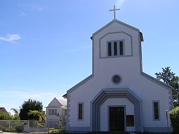
We started walking from the village church (834m) up the road and path, until after 2km we arrived in the forest. From there we headed east about four more kilometres until we reached a viewpoint known as the Morne de St François (about 930m altitude), from where we had great views of the north and north-east of
Reunion.
 |
| Morne de Saint François signpost |
At this point technically we were no longer in Le Brûlé, but in another district of Saint Denis called St François.
 |
| looking north-east across Ste Marie to Ste Suzanne |
 |
| Ste Clotilde, a suburb of St Denis |
 |
| Saint Denis centre |
Looking straight east we could see
Pic Adam (1124m), which is an easily-recognisable crater found in the hills above Bois de Nefles, a neighbouring district of Saint Denis. (It takes its name from the grandson of
Admiral Bouvet, a former governor of the
Mascarene Islands, who was ruined after setting up an
optical telegraph with
Mauritius).
 |
| Pic Adam crater |
We were surrounded by beautiful vegetation - wild
camellias and
azaleas grow particularly well at this altitude.
 |
| Azalea |
 |
| Azaleas |
 |
| wild orchid |
On leaving the Morne we had to retrace our footsteps for about 700m until we joined a path that allowed us to head up to Mamode Camp, an area above Le Brulé where we had a picnic lunch.
After lunch we headed along another path known as the PreVallée, the highest point of our hike at about 1200 m altitude.
 |
| part of the Prevallée path crosses muddy ground |
 |
| Tibouchina urvilleana / Princess Plant |
We didn't go to see the Cascade Maniquet waterfall because as we're at the end of the dry season there's no water to be seen there.
Afterwards we just needed to head down hill back to the church where we'd left our cars.
 |
| Map |
All in all it took us about 7 hours to cover an 18km-loop at a leisurely pace (about 4km/h on average), including our stop for lunch.
If you liked this, you might like:


No comments:
Post a Comment