Showing posts with label Sainte Rose. Show all posts

Sunday, 3 January 2021

Domaine de la Roseraye, Ste-Rose

Domaine de la Roseraye is a small former sugar factory in Sainte-Rose, on Reunion's south-east coast. We were some of the first people to visit it as part of a new series of guided tours organised by Les Aventuriers de l'Est in partnership with the site's owners, the Adam De Villiers family.


The site has belonged the Adam De Villiers family since the turn of the last century, but the former sugar factory ruins left there predate them and are probably mid-nineteenth century. 


The remains include an (incomplete) boiler, a broken flywheel, and a small sugar cane mill. They are interesting because Domaine de la Roseraye is one of the few, if not the only, factory sites on Reunion that has been left virtually as it was. Its small size is typical of properties of the time, and it's a piece in the jigsaw puzzle of the island's sugar cane industry development.


Incidentally until the late 19th century the only way to reach Ste-Rose from the north and east was by sea. The bridge over the Rivière de l'Est - the world's longest at the time - was only built in 1894.


The family had some archaeological work carried out between 2015 and 2018 but frustratingly French regulations mean that if there is no active archaeological research being carried out the site has to be recovered in order to preserve what's underneath. Prior to 2015 it was a guest house, with rooms in the converted stables. The actual house is quite unprepossessing and was apparently never lived in full-time. Located in such a backwater it didn't need the bling-bling of houses such as those on St-Denis' Rue de Paris for example.

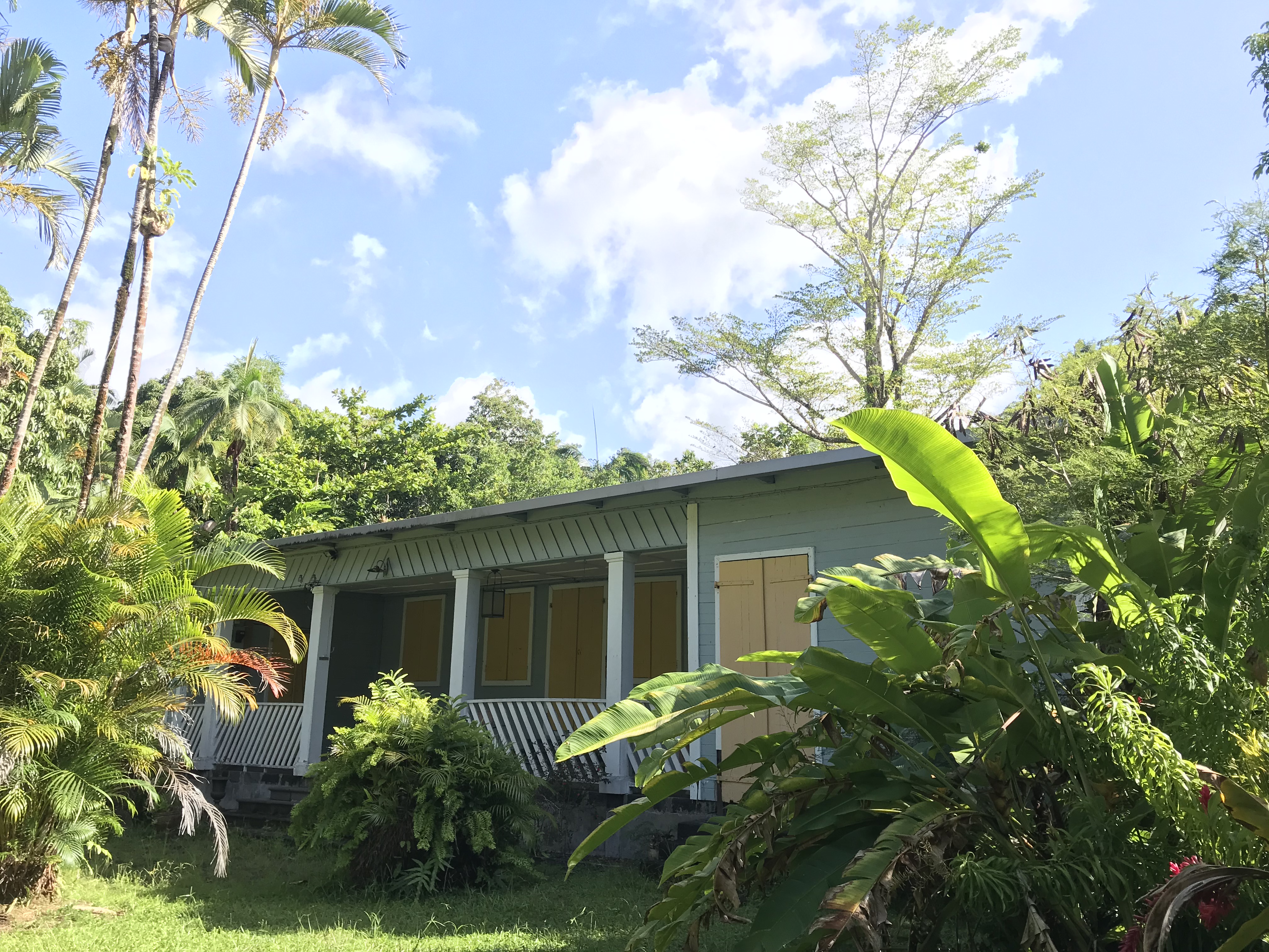
house at Domaine de la Roseraye

verandah of the house at Domaine de la Roseraye

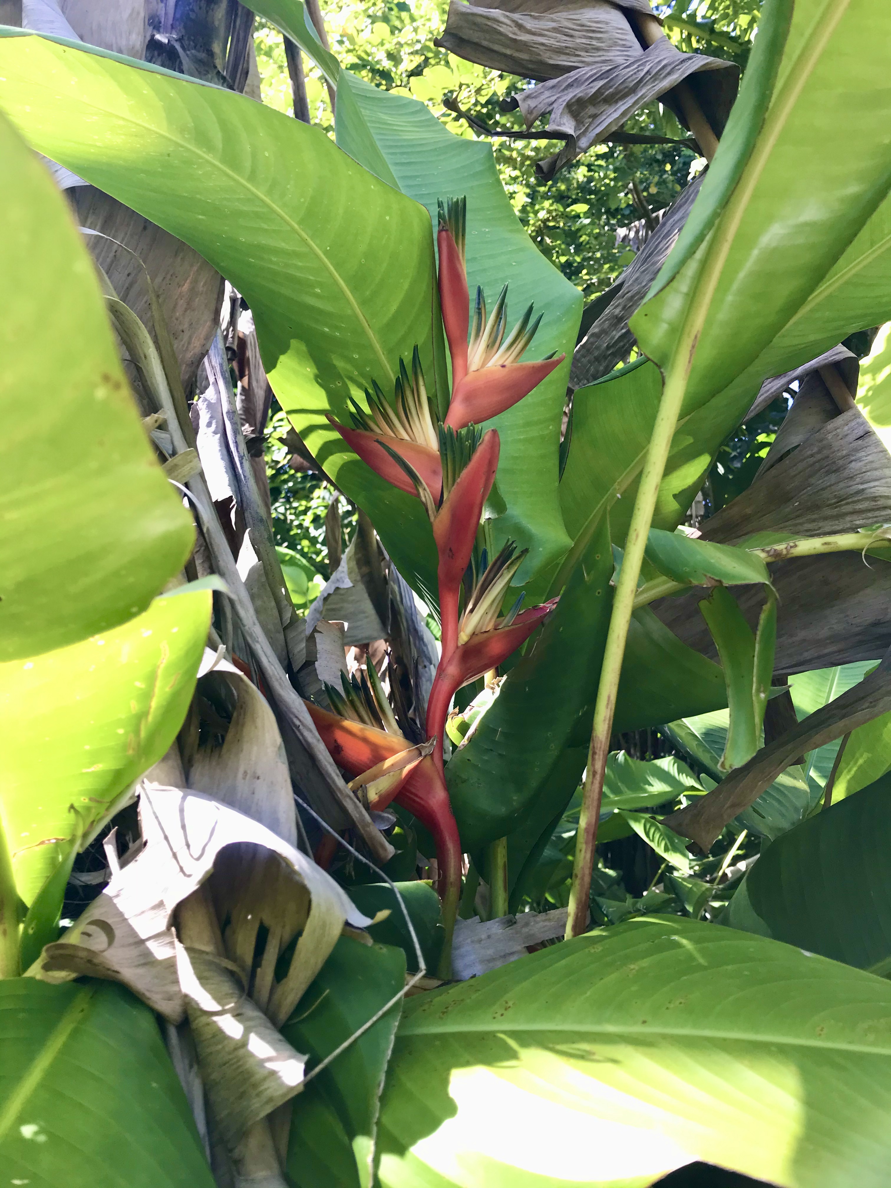
Whoever planted the garden must have loved Heliconias, as I've rarely seen so many different varieties in one place!


Heliconia rostrata


Heliconia chartacea

There were also plenty of other plants and trees in the garden. As Ste-Rose is located on Reunion's windward coast it gets lots of rain, which means gardens in the area are extremely lush.

starfruit flowers

Lipstick palm (Cyrtostachys renda)


Incidentally a TV journalist was there at the same time as us, and her news segment can be seen here:

Domaine de la Roseraye guided visits take place on the 1st Sunday of every month and you should contact Les Aventuriers de l'Est at aventuriersdelest@gmail.fr or 0692 34 45 21 to book. Visits for 15 or more people can be organised on other dates.

See also:

Saturday, 28 February 2015

Under the volcano - visiting Reunion's lava tubes


Fancy visiting the bowels of the earth? Crawling under a volcano along tunnels that were still molten magma just over a decade ago? This is what you can do when you visit Reunion's lava tubes.

Looking out to sea from the starting point

Although lava tubes are located all over Reunion, access to most of them is to be found in the island's south-east, in an area known as Le Grand Brûlé. This is where lava sometimes flows from the Piton de la Fournaise into the sea.

ʻAʻā lava to the left, pāhoehoe lava to the right

The particular lava tube that we visited dates from a 2004 eruption, eleven years ago. I believe that is the most recent lava tube in the world that can be visited by the public. Reunion's lava tubes are also fairly unique in that they are easy to access and show a large variety of geological forms. Elsewhere in the world lava tubes can be found in Iceland, Azores, Canary Islands, and the USA.

Tree bark imprint on lava

Although some people visit the tubes by themselves, it's highly recommended to go with a professional, which is what we did. We had been asked to wear trousers and closed shoes, and he equipped us with gloves, hardhats, headlamps and optional elbow and knee pads. Our meeting point was at the nearby Vierge au Parasol: the statue of a madonna holding a blue parasol. According to legend a local farmer placed this statue in his fields, hoping his crops would be protected from destruction by the volcano. Following an eruption he found that although lava had flowed through his fields the statue had miraculously been spared. 

Vierge au parasol (source)

Our guide, a trained speleologist, told us he knew of 22 entrances to the lava tube we were visiting that day; however we only used two - one to get in and one to get out!

Lava tube entrance 

We opted for the 3-hour 'discovery' visit, which covers about 1.6 km (1 mile). The same company also offers a 5-hr 'classic' and a 6-hr 'sporty' visit.

Inside the entrance looking out

A lava tube is a natural conduit formed by active low-viscosity lava which flows beneath the hardened surface of a crust or roof of lava. 

walking down the tube

When the supply of lava stops after an eruption or if lava is diverted elsewhere, lava in the tube system drains downslope and leaves partially empty, long, cave-like channels beneath the ground.

walking down the tube

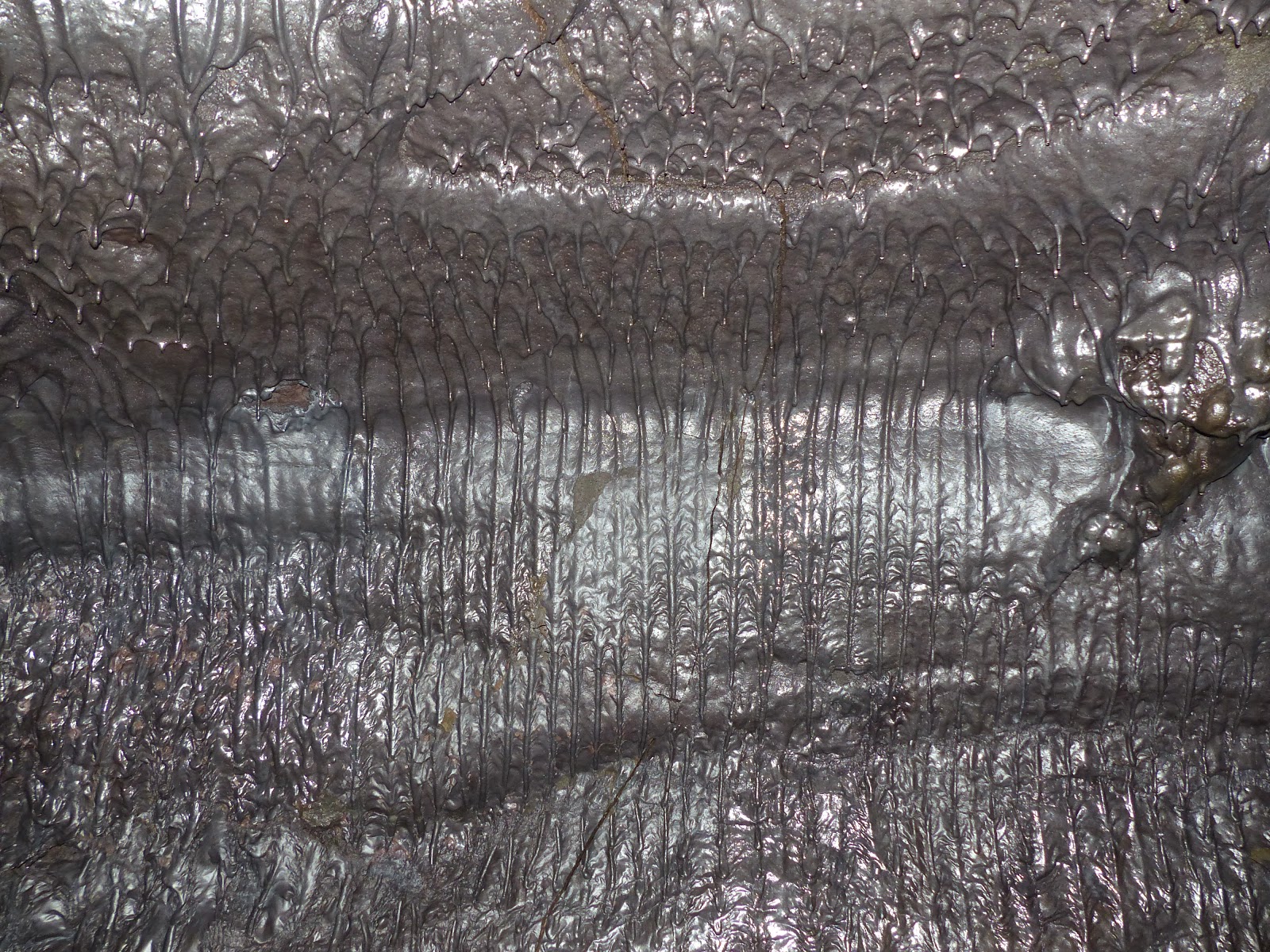
Lava stalactites and stalagmites are known indifferently as 'lavacicles' and form in lava tubes while lava is still active inside. The formation of lava stalactites happens very quickly in only a matter of hours, days, or weeks, (whereas limestone stalactites may take thousands of years to form). A key difference with lava stalactites is that once the lava has stopped flowing the stalactites cease to grow, so if the lavacicle is broken it will never grow back.

shark's tooth-shaped lavacicles

We saw several examples of what is called perimorphosis, which occurs when an object, in this case a tree trunk, leaves an empty cast in volcanic flow.

example of perimorphosis

The lava sometimes leaves peculiar shapes, such as a dodo; at one point we even saw what looked liked a giant slice of chocolate cake!

does this look like a shark's head to you?

can you see a lion's head, complete with mane?


A rare characteristic that can occasionally be seen is lava pillars. Lava pillars are hollow inside, forming a pipe-like channel between the bottom and the top of a lava flow. 

A small lava pillar

The tube was always wide, but sometimes not very high. Most of the time we could walk along it normally, but not always. I'm 5'1" and reasonably athletic so I never had to go down on my hands and knees (if necessary I moved forward using an ungainly squatting position!) but some people preferred crawling. At a few places our guide indicated alternative narrow side tubes that the thrill-seekers in our group could wriggle along.

crawling along a narrower alternative route

It was surprisingly hot inside the tube (more or less the same temperature as outside, so high 20s°C), and the humidity level was high too (100%).

wall detail

In several places we saw thin roots of vegetation hanging down.

wall detail

If it rains it only takes about 30 minutes for the rain to filter through into the tube, and it can take up to three weeks for it to stop dripping afterwards.

roof detail

One of most memorable moments was before turning back, when we all sat down and turned off our headlamps. We found ourselves in complete and utter pitch darkness, which is something you realise you very rarely experience ...

roof detail

After a fascinating morning we were nevertheless happy to be back in our natural element - with natural light and fresh air!

Bois de rempart trees are the first endemic species to colonise a lava flow after an eruption

Note that visiting the lava tubes is not recommended for claustrophobics or people with heart, breathing, knee or back problems.


Related articles:


Friday, 23 December 2011

Crags and Craters: book review


The full title of this book by William Dudley Oliver (WDO) is "Crags And Craters: Rambles In The Island Of Reunion". Originally published by Longmans, Green, and Co. in  1896 it has been republished by Bibliolife as an exact reproduction (i.e. it's not an OCRed copy). However Bibliolife made an error with the title and called it "RambleRs in the island of Reunion".

view near Cilaos

The author spent six months in Reunion from July 1895 to January 1896.  We never find out much about the writer or why he came to Réunion, although it would seem he knew previously the then British Consul on Reunion, Courtenay Walter Bennett. According to this link Bennett had been named Consul to Reunion in 1890. A British Consul on Reunion at that time would have had quite a lot of work as there were many indentured Indian labourers on the island, and as India belonged to Britain at the time, they fell under his jurisdiction.

Sir Courtenay Walter Bennett in 1932 © National Portrait Gallery, London
Sir Courtenay Walter Bennett in 1932
© National Portrait Gallery, London

Coming back to the author, as a 19th century white and (presumably) upper class male he came to the island with a baggage of colonial beliefs and prejudices rather typical of his upbringing, and this should be borne in mind while reading the book. However despite this, on the whole he is generally fair and decent in his written treatment of the island's inhabitants.

The Gros Morne
Gros Morne

While on the island and not hiking he seems to have spent much of his time in Hellbourg at the Châlet Consulat due to the heat on the coast. "It is an absolute necessity for Europeans dwelling in a tropical climate to have some place to which they can go to recruit their exhausted energies"(page 46).

Gorges of the Rivière des Galets
Gorges of the Rivière des Galets

Possessed with a lot of energy and/or curiosity he hires a guide and some porters (who all walk barefoot!), and over the course of six months manages to visit most of Réunion's summits: the volcano, Piton des Neiges, the Salazes etc. When unable to reach a peak first time, he returns to try again! The only mountain that he didn't manage to  conquer was the Gros Morne, unsurprisingly (it was only ascended for the first time in 1939).

map of Reunion from the book

For anybody who knows Reunion many of the place names he mentions will be very familiar : Cap Anglais, Belouve, Coteau Maigre, Cap Noir, etc. etc. However some things which have disappeared today are striking to the modern-day reader: for example WDO often uses the railway, and he makes a trip to the village of Mafate (in the eponymous cirque) which disappeared in 1913.

The Piton des Neiges

I'll leave the last word to the author, who was on his way to the cirque of Salazie: "... I felt that this drive alone was worth the voyage to Reunion. And yet, grand as it is, it is but a foretaste of the glories awaiting in this wonderful island." Sentiments with which a modern day visitor to Reunion might well agree.


Footnote 1:


On pages 25-26 of the book WD Oliver mentions "an obelisk built of native stone and mounted on a pedestal" which had been "erected to the memory of the English who fell at the taking of the island in 1810." He includes a photo of the obelisk set on the (then) visibly grassy Plaine de la Redoute. 
Curious, I went to see the monument as it today. It is now part of a small park and stands not far from the (much larger) French monument to those who fell at the same battle.

The obelisk today (source)

Two sides of the pedestal are blank, on one side is the following inscription: 

"Sacred to the memory of 
Lieutenant John Graham Munro
of his Britannic Majesty's 86th Grenadiers 
who fell near this spot 
while charging the Enemy 
on the 8th July 1810
Aged 22 years
This tomb is erected by his Brother Officers
in testimony of their Esteem and Regard."

inscription to the memory of Lt. Munro

On the other side is the following inscription:

"Near this spot 
Are also interred
the remains of those Brave Soldiers
of his Majesty's
Eighty Sixth Regiment
who likewise fell
on the same glorious occsion"

inscription to the memory of the other "brave soldiers"

As you can see "occasion" is missing an 'a' in the original. Talking of omissions, in a footnote on the subject of the monuments the author says "there is a story that a certain Governor of Réunion, in a copy of the inscription which he made, carefully omitted the word 'glorious' - an instance of small-mindedness which it would be difficult to beat".

The French obelisk, erected in 1857


During the battle 7-9 July 1810 exact numbers of French losses are unknown, but the British lost 22 men and 79 were wounded.

inscription on French monument


Footnote 2:

On pages 159-161 the author says:
Before breakfast I walked down to the little quay [of Sainte Rose] to take a photograph of the monument erected there to the memory of Captain Robert Corbett, who was killed in action off here on September 13th 1810 while in command of the Africaine. The monument consists of an obelisk close to the shore, and, with the exception of an anchor in relief, is without ornament. There is no inscription.
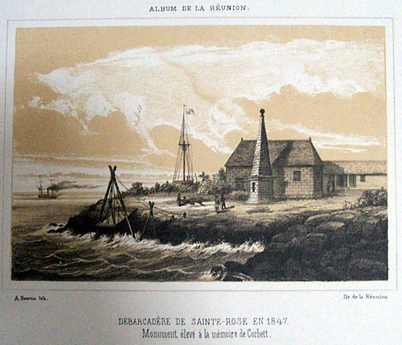
An 1847 engraving of the port of Sainte Rose, showing the monument


Here are some modern-day photos of the statue at Sainte Rose:

Corbett monument, Sainte Rose

The anchor in relief referred to is found on two sides of the obelisk.

another view of the monument, showing one of the anchors

Near the monument is a plaque, unveiled by Ste Rose's mayor on 23rd August 2009 to mark the 200th anniversary of a slightly earlier battle, and which reads:
Place du Commandant Hubert Delisle.
Historical site of the 23rd August 1809 naval battle between the French and the British.
Commemorative plaque

one of three nearby cannons


Further reading:

See also this video which shows the marina and statue at Ste Rose.


You might also enjoy: