
At an elevation of 2898 mètres Grand Bénare is Reunion's third highest peak*. I had hiked it once before, a very long time ago, and recently decided I wanted to hike it again. Last Tuesday (Bastille Day) we got up very early and drove up to Le Maido, where we parked. After a quick look out from the viewpoint, we started the hike itself.
 |
| View from Le Maido showing Mafate in the foreground and Salazie behind (if you look closely you can see the east coast) |
When we parked the car at around 8am it was only 7°C, and we made sure we were well wrapped up against the cold. Fortunately as it was a sunny day we soon warmed up while walking.
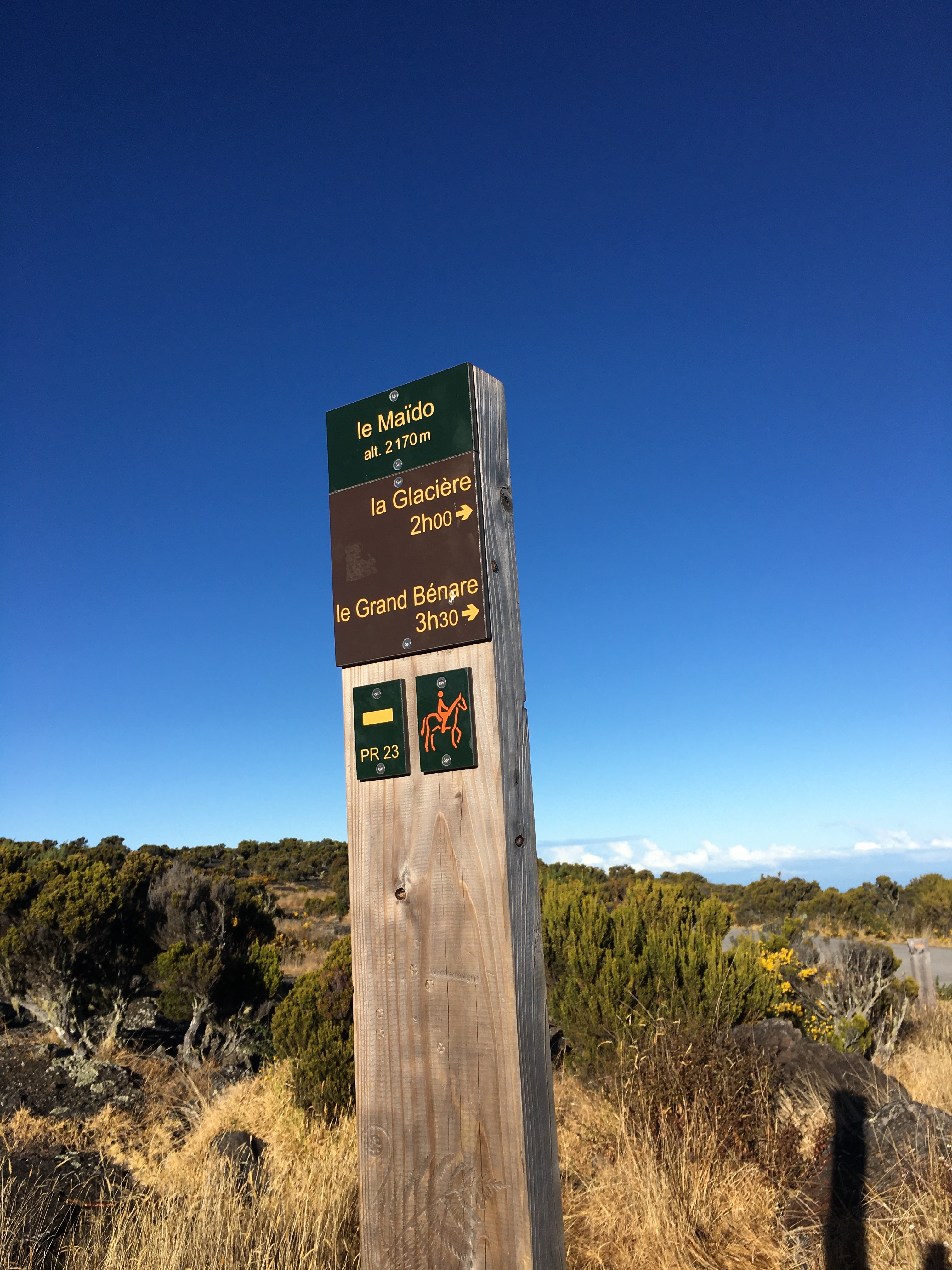 |
| post at start of hike showing altitude & hiking time (3½ hours) |
Grand Bénare is the highest point of the narrow municipality of Trois Bassins. Trois Bassins (literally "three pools") is a textbook example of the "From the seashore to the mountaintops" principle (in French Du battant des lames au sommet des montagnes, literally "From the beating of the waves to the summit of the mountains") of land concession, whereby early settlers cut land into straight bands that stretched from the shore to the highest points without ever widening horizontally.
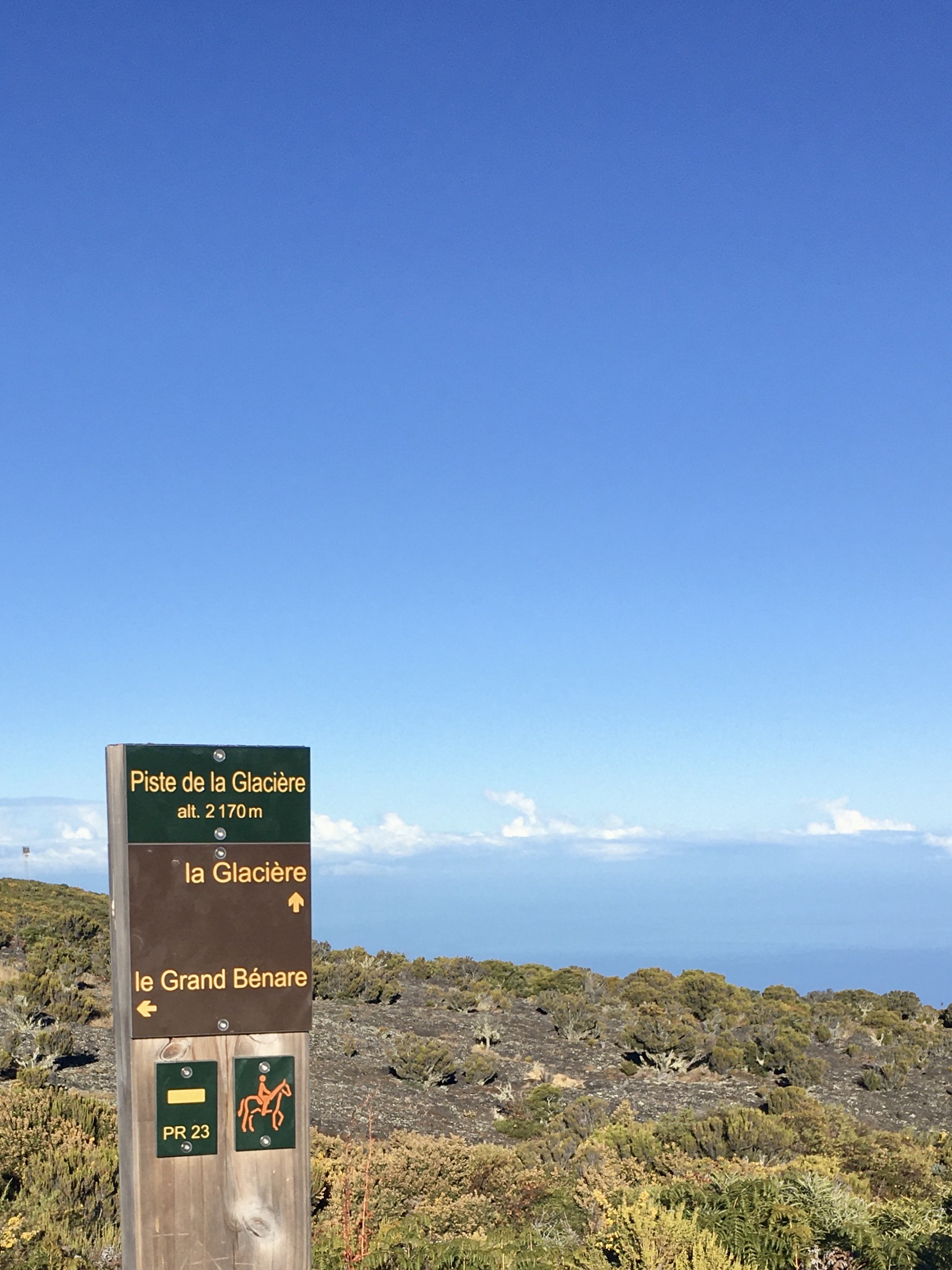 |
| post showing hike via La Glacière (see below) |
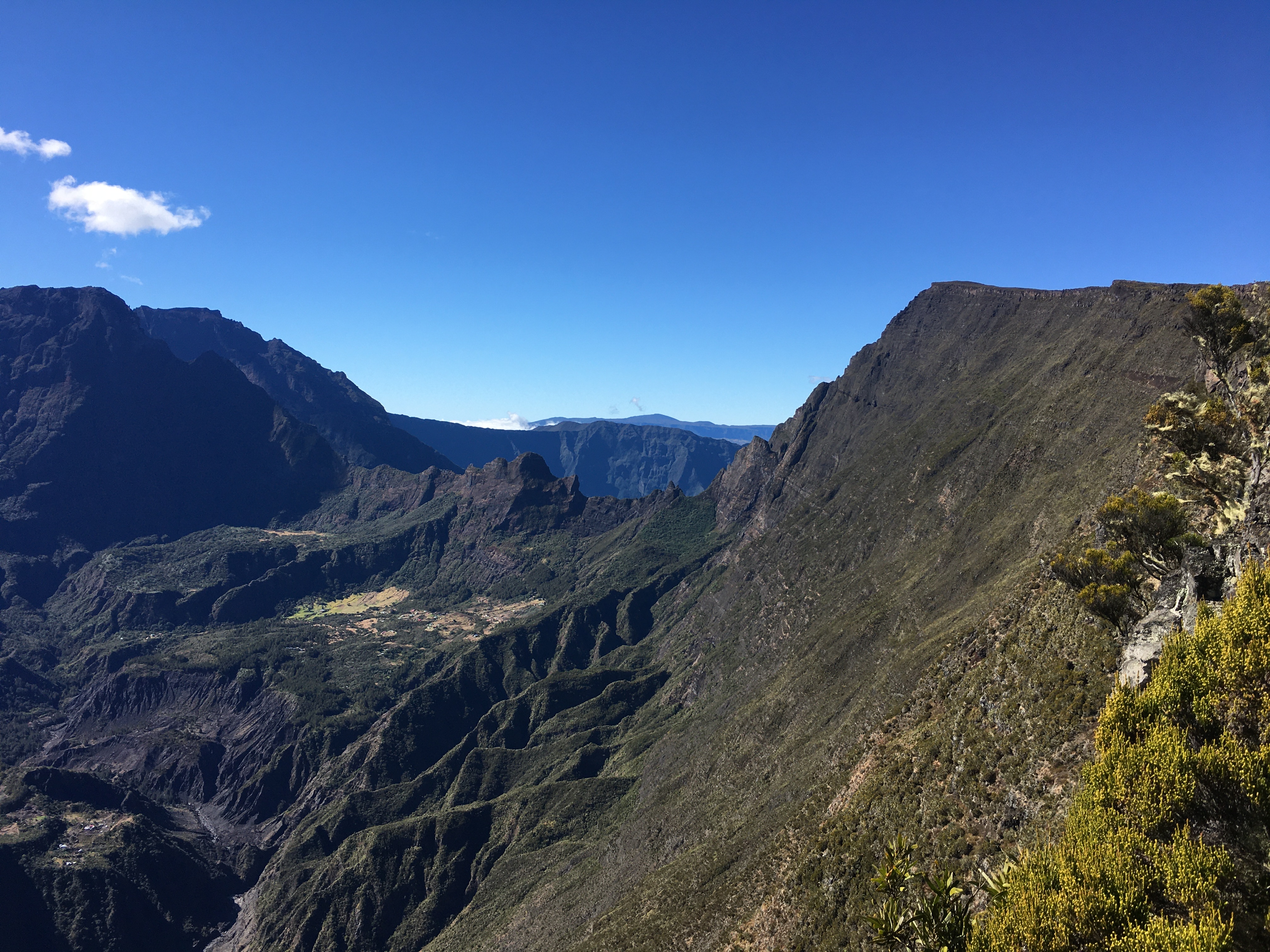
The hiking path we took is known as Grand Bord because it follows the edge (border) of the mountain ridge: to your right it slopes gently down to the west coast, but to your left it drops away sharply giving you a spectacular view of the whole mountainous interior of the island. If you're also going to visit La Glacière (see below) it definitely makes more sense to hike to Grand Bénare along the Grand Bord path first because the view is more likely to be free of cloud in the morning. You can then hike back via La Glacière, which is slightly inland. As July is the cold season in Reunion (= less rain, so less clouds) we were fortunate because the sky remained cloud-free virtually all day.
 |
| Grand Bord hiking path follows this ridge Grand Bénare is the highest point, to the left |
 |
| view over Mafate: La Nouvelle centre left, enormous Gros Morne behind |
 |
| looking down over northern/lower Mafate: in the foreground is the hamlet of Roche Plate and flat-topped Le Bronchard |
 |
| Gros Morne to the centre left, Grand Bénare extreme right |
 |
| Piton des Neiges behind Gros Morne to the left, Grand Bénare to the right, Piton de la Fournaise just visible in the far background centre |
 |
| Grand Bénare to the right, Gros Morne to the left |
 |
| vegetation is sparse at this altitude |
The hike isn't very difficult from a technical point of view but is quite a long slog, with about 800 meters of elevation gain, and the path is rocky. On arrival at the summit we were greeted by a large white cross and a view over Reunion's third cirque, Cilaos.
 |
| cross at the summit of Grand Bénare, Cilaos behind |
 |
| view from Grand Bénare to the south coast |
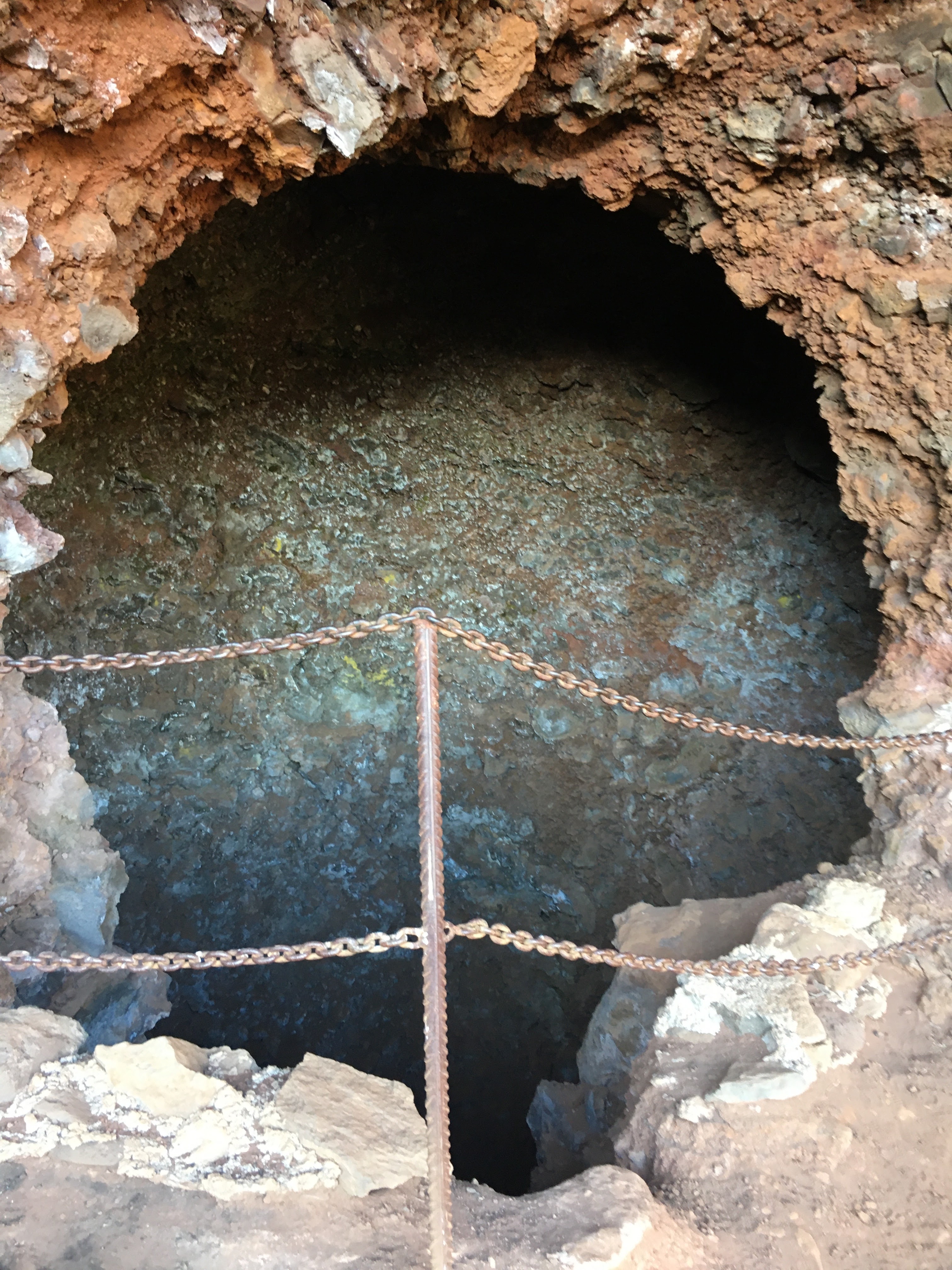
Our arrival at Grand Bénare coincided with lunchtime and after eating our packed meal, sitting well wrapped up against the cold, we set off back down via a different route: La Glacière (altitude 2490m). Bénare actually means "where it is very cold" in Malagasy, and at La Glacière two hundred years ago some brick shafts were built to store ice that was cut from surrounding pools of water.
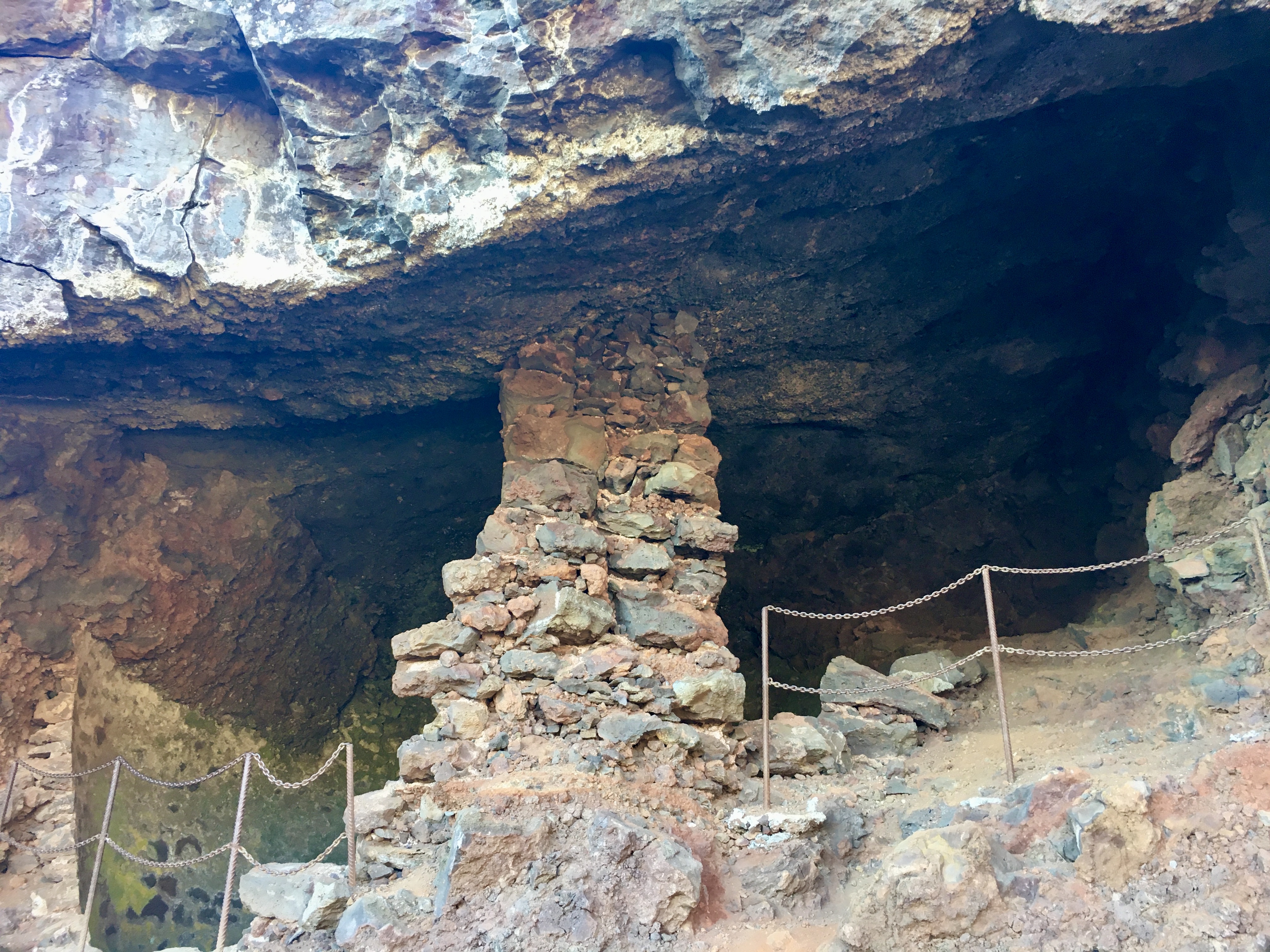 |
| ice-storage shaft at La Glacière dating from 1820 |
During the period of slavery, land owner Mme Desbassyns would send slaves to La Glacière so they could carry ice down to her mansion at Villèle, a 60-km round trip. 25 kg blocks were either transported whole in hessian bags or crushed then wrapped in woollen blankets to stop them from melting. She enjoyed impressing her visitors by serving them sorbets and iced drinks. She also sent some of the ice to her son who lived at Rivière des Pluies, Sainte-Marie, using a system of relay riders. Mme Desbassyns died in 1846 and slavery was abolished two years later, but the practice continued for several decades more, apparently with impoverished labourers scraping out a living by collecting and delivering the ice.
 |
| ice-storage well at La Glacière |
The path from La Glacière back to Le Maido car park is relatively flat and straight, which was welcome relief for our legs after the stony terrain of Grand Bord! (As there were a number of forest fires in the area during the early 2010s, the fire brigade wanted to make sure they could access the area in all-terrain vehicles if needs be, so they flattened the track). And although we saw a lot of gorse bushes all day, they were particularly present by the side of the path for the last kilometre or so. Their yellow colour makes them attractive but they are in fact an invasive species, imported in the 1850s as a way of fencing animals in.
 |
| gorse bushes by path side |
The total hike was about 16km long (≈9km along Grand Bord, and ≈7km on the way back via La Glacière), and took us most of the day.
* The two highest peaks are Piton des Neiges and Gros Morne respectively.
You might also like:
- Hiking from Maïdo to Ilet Alcide
- Maïdo & Petite France
- A round-up of some blog articles about Reunion ("Le Maïdo, a unique vantage point over Reunion Island")
- Some Reunion Island & Indian Ocean stamps (see 1960 stamp)
External links: