Sunday 6 December 2020

Cascade Blanche

Falling 640 metres, Cascade Blanche is one of France's highest waterfalls, and Reunion's third-highest (the tallest is Trou de Fer). Often associated with Salazie as it lies near the entrance to the cirque, in fact it technically falls within the municipality of Bras Panon. It's very visible on the drive in and out of Salazie cirque, although on the way in you have to look back over your shoulder just past Pisse en l'Air to see it.

Cascade Blanche

Getting to a good viewpoint just opposite the waterfall is a fairly easy 35-minute hike, although actually getting to the foot of the waterfall is a little more "athletic" (it involves fording a river, wading through muddy channels, and clambering over large boulders).

sign near the start of the hike

Forestry Commission sign at start of hike,
warning that part of the pathway is unstable

a species of Heliconia growing wild
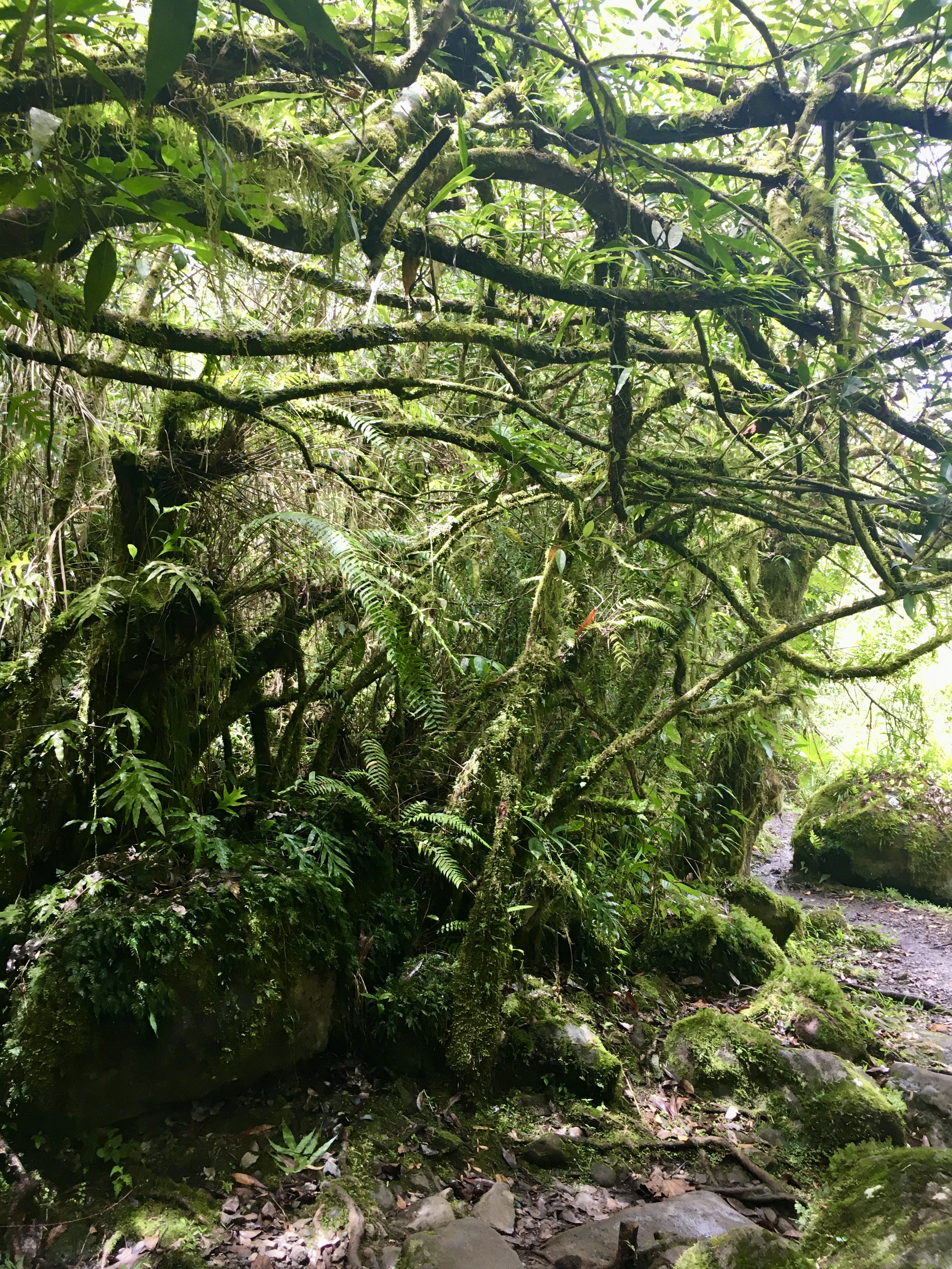
part of path

sign at the viewpoint marking the end of the maintained
path. While it doesn't forbid from going any further,
it warns hikers to watch out for flash floods in the river

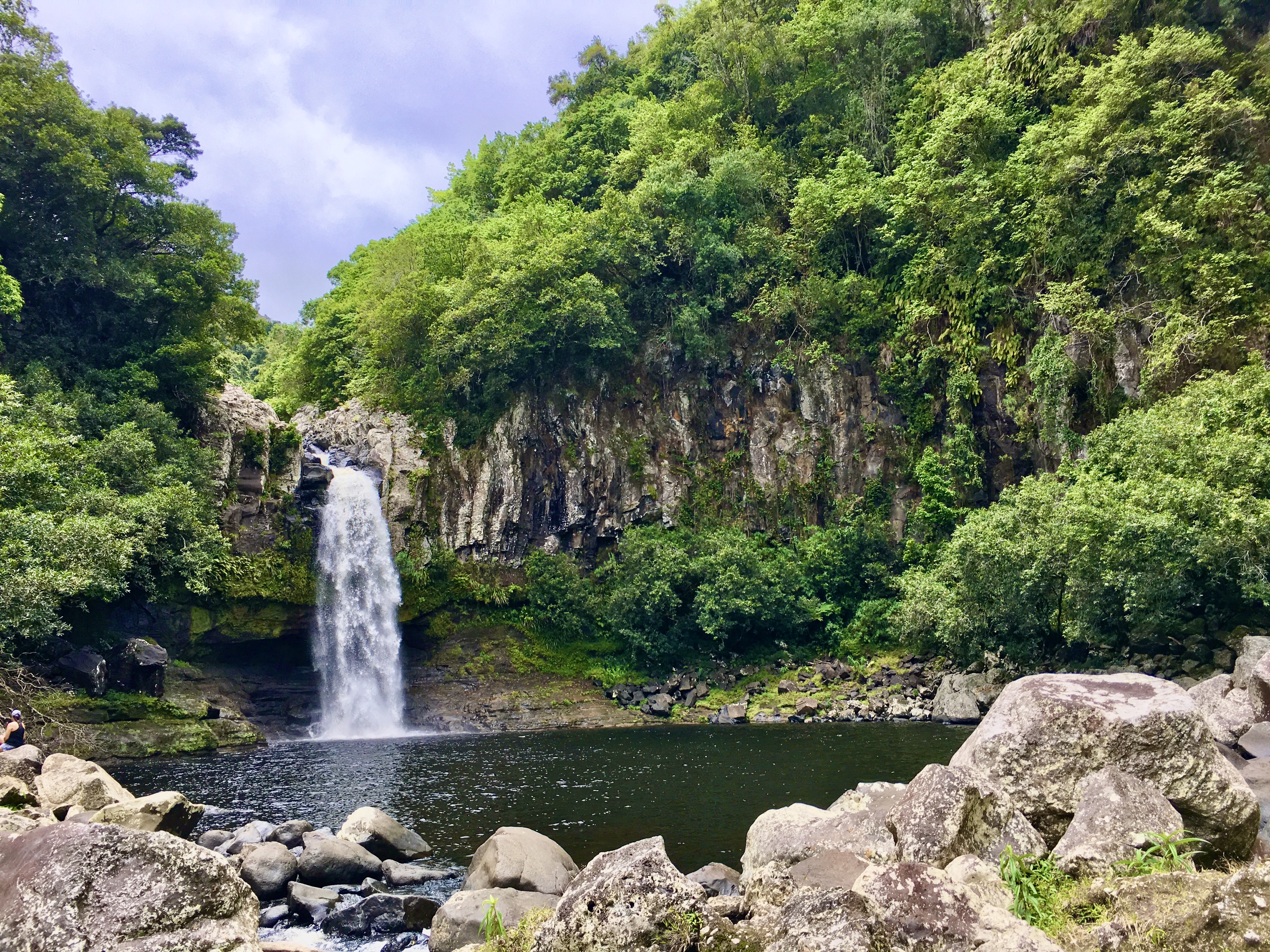
view of Cascade Blanche from the viewpoint

After cooling our heels ankles in the river (called Bras de Caverne), we then made our way to the foot of the waterfall where we took a dip in the water before making our way back.


If you read/understand French you can find out more about the hike here:

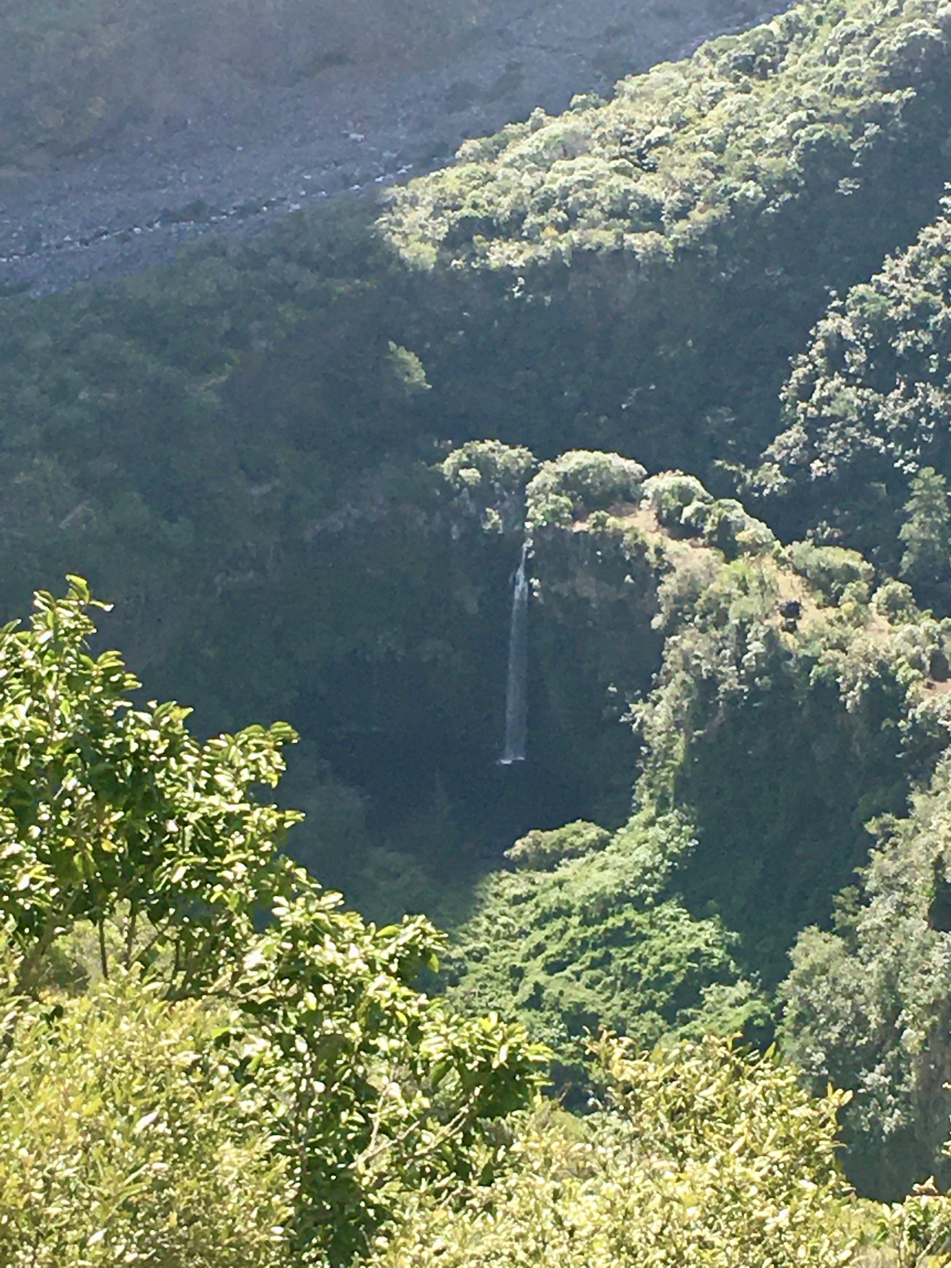
view on the way back

See also:


Sunday 29 November 2020

Rivière du Mât

Although I worked for 9 years at Bourbon Plastiques, I never hiked this path up alongside the Rivière du Mât river although I'd heard about. It's now been 12 years since I left BP to move to Seoul for three years, so when an outing to Rivière du Mât was suggested by a group of friends I was keen to participate.

Bourbon Plastiques roofs are just visible behind the vegetation

It's not a very difficult hike, and the path is flat most of the time. We only went as far as Bassin des Aigrettes, which should not be confused with its homonym at Saint-Gilles, although they do look similar.


At one point on the path a sign indicates Bassin De La Mer, which is a bit further on and slightly steeper to get to. Again this should not be confused with its near-homonym Bassin La Mer at Saint-Benoit.

sign to Bassin De La Mer

Bassin des Aigrettes, Rivière du Mât

The way back was by the same path, and we stopped off to cool our feet in the river.

Rivière du Mât, looking east towards the sea

The area near the carpark where the hike starts and finishes has been landscaped to a certain extent, and there are some attractive plants as well as some old remnants of the former sugar factory that Bourbon Plastiques stands on the site of.


jackfruit growing

Heliconia

ornamental banana

If you're interested in this hike, information in French can be found at La boucle des Bassins de la Mer et des Aigrettes depuis la Rivière du Mât.


See also:


Thursday 8 October 2020

Sentier des Cordistes from Moulin Kader

Moulin Kader is a near-derelict old mill at La Montagne which was used for making fibre similar to sisal out of kader (also known as cader or choca) leaves. It's also the start of a hike known as the Sentier des Cordistes as the path (sentier) passes by the top of the gigantic netting that is used to stop rockfalls on the Route du Littoral. These nets are installed and maintained by cordistes (rope access technicians), hence the name of the path. The Route du Littoral, which currently runs at the base of the cliff we were walking on top of, is due to be replaced by a new offshore coastal highway within the next year or two. We had amazing birds-eye views of the road under construction from certain parts of the path.

old and new coastal highways

top of rockfall netting

fastenings at top of rockfall netting (source)

Although I'd walked to the Moulin Kader picnic spot at the start of the hike before, I'd never been any further. The overgrown path was cleared by a local family during Reunion's lockdown and is now much more accessible than it was before.

looking back


some parts of the path have rough steps

looking north-north-east

part of the path


another view looking back

looking out to sea

The hike can be done as a loop, and can be of varying lengths depending on how much of it you do (we only hiked 4 kilometres, for example). For more information on the time and distance see (in French):

me, striding forward!

See also:

Monday 21 September 2020

Grand Bassin

Grand Bassin, in the south of Reunion Island, is sometimes nicknamed "Little Mafate" due to the fact that, like the cirque of Mafate, you can only access it on foot. Grand Bassin literally means "large pool" and is actually the name of the small village, while the nearby waterfall is called Voile de La Mariée (not to be confused with the more well-known waterfall of the same name in Salazie).

view of Grand Bassin, waterfall and pool just visible to the left

There are several hiking paths to access Grand Bassin, but the most popular is the hike down from the Belvédère (look-out point) of Bois Court in the municipality of Le Tampon. A study between January and September 2017 found that Grand Bassin was Reunion's fourth most popular hiking path, with 79,537 passings during those nine months (bear in mind that a "passing" may be the same person walking there and back).


It actually took us about 2 hours to hike down to the village, but only 10 minutes more to hike back up the next day. The incline is quite steep as the elevation difference is about 700 metres over a distance of 4.5 kilometres. As you can see from the sign pictured above, the waterfall is about 30 minutes further on from the village.

Grand Bassin seen from Bois Court

view of the coast and the Bras de la Plaine river,
taken from the hiking path at an elevation of 1200 metres

shrine to Ste Rita or Ste Bernadette by the side of the path

recent street art (or should that be "path art"?)

view of the waterfall when nearing the village

view of the path not long before arriving at Grand Bassin

looking north from near the village

Villagers used to earn their living from cultivating geranium and coffee but in recent years have increasingly turned to tourism. Last time I came to Grand Bassin in 2004 there were only three gîtes if I remember rightly. Now there are at least nine! The gîte we stayed in was very welcoming and we were offered a free drink of tea or coffee on arrival. The evening meal was very copious and included some unusual ingredients such as chayote root and taro stem.

looking inside the village chapel

Another difference compared to 2004 was increased awareness-raising about one of the world's rarest birds, the critically endangered Mascarene Petrel, which is thought to nest high up in the surrounding mountains, (although the bird is so rare that no nest has ever been discovered). Known locally as the timize, its otherwordly cries made the area's early inhabitants wonder if a monster lived in the mountains, and this gave rise to a number of stories and legends. 

possible petrel breeding sites?

Another endangered (as opposed to critically endangered) bird that lives in the surrounding mountains is Barau's Petrel, known locally as the tayvan or taillevent. I translated and recorded the English voiceover of a documentary about it, which you can see here.

Grand Bassin beekeepers

After a good night's sleep and a filling breakfast we headed to the waterfall, passing some hives and beekeepers along the way.


viewpoint over the waterfall before reaching it

main waterfall

main waterfall to the right
(and that's me behind the smaller waterfall to the left)

Afterwards, we headed back to the village where we picked up some sandwiches we'd ordered before the hot and dusty slog back up to Bois Court!

the way back!

See also:

You might also like: