Saturday, 15 August 2015

Dublin & Central Ireland

After leaving Northern Ireland we headed across country to Dublin, Ireland's capital city.

Frieze on Sunlight Chambers, Parliament Street 

I was interested to visit Fishamble Street as (1) it's the oldest street in Dublin, dating back to Viking times, and (2) it's the place where Handel's 'Messiah' (one of my favourite pieces of music) was first performed in 1742.


statue of James Joyce, O'Connell Street 

statue of CS Parnell (Home Rule advocate),
northern end of O'Connell Street 

Dublin Castle

World-famous Trinity College was founded in 1592 by Elizabeth I, and its alumni include Jonathan Swift, Oscar Wilde, and Samuel Beckett.


Sphere within a sphere sculpture by Arnaldo Pomodoro at Trinity College

After two nights in Dublin we headed over to the west coast and Connemara. This was the lovely view from our B&B in Spiddal.


I was mad on horses when I was growing up, and at the time Connemara was familiar to me only as the name of a breed of ponies. 

windswept Connemara ponies

'Conamara' actually means 'Inlets of the Sea' in Irish.


an isolated cottage in Connemara

locals have an abundant supply of peat to heat their homes with

We then headed to the city of Galway.

Galway Cathedral, with Salmon Weir Bridge to the left, 
crossing the Corrib River (Europe's shortest river).

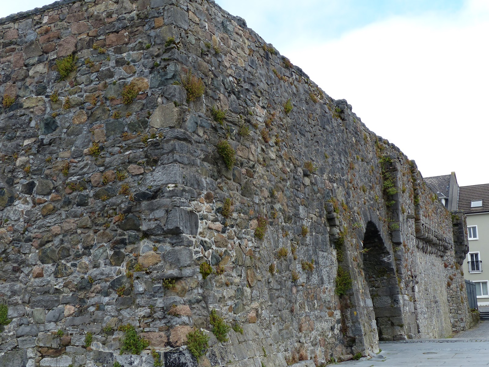
Spanish Arch, Galway, a remnant of the town's medieval walls

Lynch's Castle, Galway, an example of a town castle

Ireland is littered with old castles!

Dunguaire Castle, south of Galway, built around 1520

Muckinish West Tower House, Galway county

In the northern-western part of County Clare is the rocky and windswept limestone Burren region.

at the Burren

Lighthouse, Inisheer, Aran islands (seen from the Burren)

Further south along the coast are the 200m-high Cliffs of Moher, one of Ireland's most popular sights.

Cliffs of Moher

Cliffs of Moher

ruined castle keep at the Cliffs of Moher

The region is home to an abundance of wildflowers.

wildflowers

wildflowers

wildflowers 

wildflowers

wildflowers

We spent a night in Ennis and then visited the town of Limerick, which for me until then had just been the name of a type of rhyme! You can visit King John's castle there, built by the eponymous English king between 1200 and 1212 on the banks of the River Shannon.

King John's castle, Limerick (12th century)

We also visited the very interesting Hunt Museum, which has fine collections of Bronze Age, Iron Age and medieval treasures.

Roman bronze dodecahedron whose use remains a mystery.
The circles are symmetric on each side.
Hunt Museum, Limerick

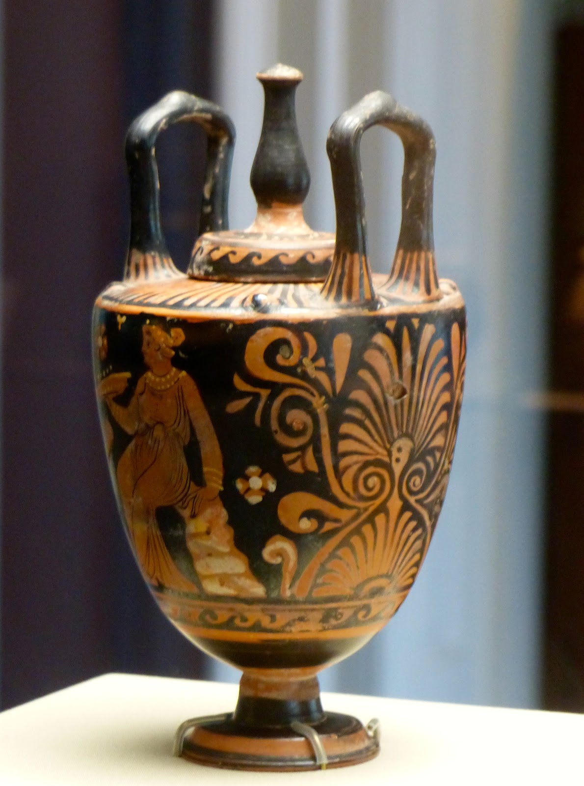
Greek water jar, 4th century BC, Hunt Museum, Limerick

Horus, 7th to 4th century BCE, Hunt Museum, Limerick

On leaving Limerick we headed to Ireland's south-west: the Dingle Peninsula.


If you enjoyed this post you might also like:

Saturday, 8 August 2015

Northern Ireland


Before travelling to Belfast, I didn't realise how strong the link with RMS Titanic was there. I always associated the famous liner with Southampton, as that's where it sailed from, but it was actually built in Belfast Harbour and first sailed from there. A visitor exhibition called Titanic Belfast was opened in 2012 and has become Northern Ireland's most popular tourist attraction.

Titanic Belfast visitor attraction building

sculpture outside Titanic Belfast

SS Nomadic, a sister steamship of HMS Titanic, launched in 1911

Belfast City Hall is a surprisingly iconic building, and can be visited on a free public tour. The Lord Mayor’s Suite there is also known as ‘the Titanic Rooms’, as craftsmen who worked there went on to work on the famous ship.

a scale model of RMS Titanic at Belfast City Hall 

Inside Belfast City Hall

Ulster Hall, a concert hall built in the 19th century

One of Belfast's best known landmarks is the Albert Memorial Clock Tower, which was built in 1869.

Albert Memorial Clock Tower

Bigfish, on the riverbank, is a giant mosaic sculpture of a salmon whose tiles depict the history of Belfast.

Bigfish, 10 metres long

Custom House, built in 1850s

Another 'attraction' in the west of Belfast are the Murals, a symbol of the region's past and present political and religious divisions. The Falls Road area is Republican, while nearby Shankhill is a Protestant district.

an Irish Republican mural showing strike leader Bobby Sands

another Republican mural

Shankhill Road, Loyalist district

Shankhill Road, Loyalist district

Shankhill Road, Loyalist district

Cupar Way peace wall

On leaving Belfast we headed further north along the coast. As my husband is a Game of Thrones fan, we visited some of the series' filming locations.

Cushenden Caves (aka 'Shadow birthplace')

Dark Hedges (aka 'Arya's Escape')

Ever since I was in school I'd always wanted to visit the Giant's Causeway, an expanse of hexagonal basalt stone columns that are the result of an ancient volcanic eruption.

Giant's Causeway

As a UNESCO world heritage site it's perpetually busy, and we were lucky to get photos with no people in them!
Giant's Causeway, close up

Giant's Causeway

We then headed to Derry/Londonderry, Northern Ireland's second largest city, and the fourth-largest city on the island of Ireland. The first thing you notice when you arrive is Hands Across The Divide, a bronze sculpture of two men reaching out to each other, symbolising the spirit of reconciliation. It was unveiled in 1992, twenty years after Bloody Sunday.

Hands Across The Divide sculpture

Elsewhere in the city a 1987 cast iron Anthony Gormley sculpture represents "the two communities divided by religion, culture and politics but united by faith and by being members of the human race".
 
Anthony Gormley sculpture

Derry is a city which I associated with the Troubles, and which until I visited I didn't realise had such a long, rich and interesting history.

Fountain housing estate in Derry - a Protestant community.

Derry is also a walled city, and its walls, completed in 1619, are 8m high and 9m thick, with a circumference of about 1.5km. Warring Catholics and Protestants led to a siege which began on December 7th 1688 and which was to last for 105 days. 

Derry city walls

When you walk the city walls today you can see reenactments of what life was like during the siege; people were reduced to eating vermin to survive.

Historical reenactment on Derry city walls.


In 2013 Derry was UK City of Culture and received somewhat of a makeover. One of the most visible legacies is the pedestrian Peace Bridge, which spans the River Foyle.

Peace Bridge, Derry

On leaving Derry we headed south across the border and into Eire for the rest of our trip.


If you enjoyed this post you might also like:

Saturday, 25 July 2015

Slacklining in Reunion Island

I've previously posted an incredible video about slacklining across the 3 Salazes, here are more videos of slacklining in Reunion, including a world record!

The first shows Swiss Raphael Bacot and his Reunionnese counterpart Kevin Borg of Slackline 974 crossing a suspended midline against a background of exploding waves on the south coast, at Cap Mechant.


© Dronecopters

© Dronecopters

The second takes place in the isolated mountain cirque of Mafate and shows Kevin crossing a 40-metre high gorge at Trois Roches. Both these exploits were filmed using a mixture of images from a Gopro (from the slackliners' point of view) and aerial shots by drones.


The third video shows Nathan Paulin setting a world record on 9th June 2015 by crossing the longest slackline in the world, 403m long and 250 metres above ground at the Cassé de la Rivière de l'Est. It took him 23 minutes to walk the 403m and he was filmed by Les six patates. (A few weeks later he set a new world record highline at the Natural Games in Millau, France – 469m).


See also:

Sunday, 12 July 2015

Mauritius seen from Reunion and vice versa

Well-known local photographer Luc Perrot published a photo this week of Mauritius seen from Piton de la Fournaise, Reunion Island. He explained that winter brings clear night skies, which make this sort of photo possible.

Mauritius as seen from Piton de la Fournaise,
Reunion Island © Luc Perrot

cropped version of the above photo © Luc Perrot

Panoramic view, with the volcano clearly visible
to the right © Luc Perrot

As some people seemed to think it wasn't possible to see Mauritius from Reunion, Mauritian photographer Burty Makoona sent the photo below, which Perrot annotated.

Reunion, seen from Mauritius © Burty Makoona

Annotated version:

Reunion, seen from Mauritius (annotated) © Burty Makoona

Another photo by Perrot was recently Photo of the Day on the Earth Science Picture of the Day (EPOD) website (EPOD is a service of the Universities Space Research Association).

Piton de la Fournaise © Luc Perrot

Wednesday, 8 July 2015

Advance warning: solar eclipse on 1st September 2016

On Thursday 1st September 2016 an annular solar eclipse will be visible from Réunion Island.

example of an annular solar eclipse

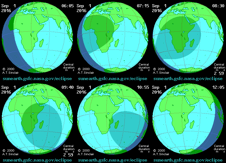
A solar eclipse occurs when the Moon passes between Earth and the Sun, thereby totally or partly obscuring the image of the Sun for a viewer on Earth. An annular solar eclipse occurs when the Moon's apparent diameter is smaller than the Sun's, blocking most of the Sun's light (in this case 97%) and causing the Sun to look like an annulus (ring).

path of the eclipse

While the whole eclipse will last from 06:13–12:00 UT, the point of maximum eclipse will last 186 seconds (3 minutes 6 seconds), and the maximum width of the band will be 100km (62 miles). It will be seen across central Africa southwards to Madagascar and into the Indian Ocean. The partial eclipse will be visible across most of Africa and parts of the Middle East. The points of Greatest Eclipse and Greatest Duration will be in southern Tanzania.

path of the eclipse

Most of Réunion will see the annular eclipse at about 10:09 UT. Although the island is not on the centreline, the duration in the south-west (near St Pierre) should be quite good, as the centreline duration is still over 3 minutes.

map showing path of eclipse over Reunion
© MICHEL VIGNAND

The last solar eclipse visible on Réunion was on 21st June 2001.


For more information:


Sunday, 31 May 2015

May 2015 volcano eruption

Réunion's volcano, Piton de la Fournaise, erupted for the second time this year on May 17th and continued erupting for two weeks until yesterday, May 30th. During the 13 days the eruption lasted at least 8 million cubic metres of lava were ejected, which corresponds to the volume normally ejected over a period of 20 days. The volcanic cone which has formed has a volume of 400,000 cubic metres, or 13 Olympic swimming pools!

Here are some photos and videos of the eruption. 

This AFP photo by Richard Bouhet was widely distributed
by the international media

© Drone copters

© Lionel Ghighi

© Sebastien Conejero

© Sebastien Conejero

Note that one of Reunion's Volcano Observatory four webcams was directed towards the eruption (bottom right-hand corner).

screenshot of the Volcano observatory webcam (source)


Update: the photo below, by Pierre Choukroun, was photo of the day for June 16th on the website Volcano Discovery.